
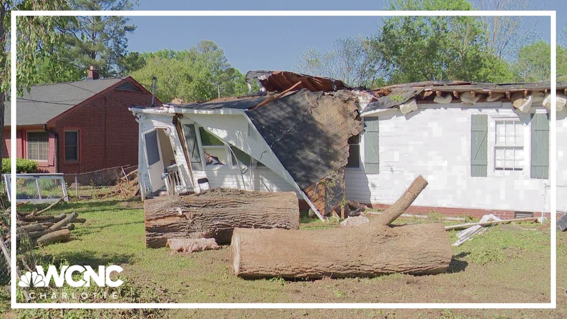
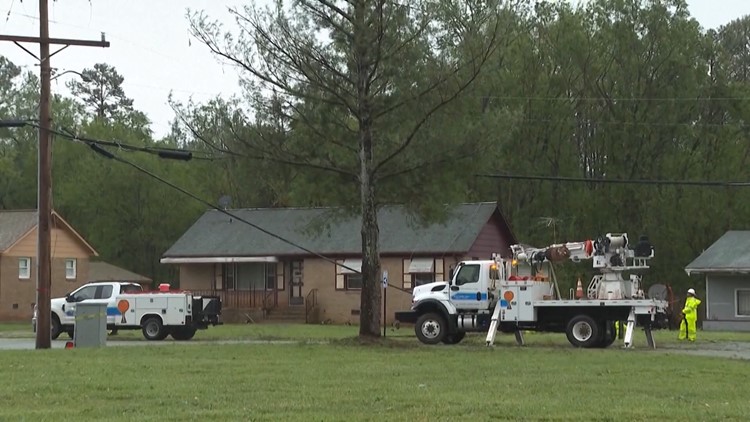
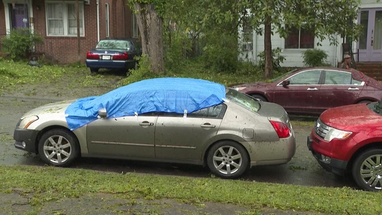
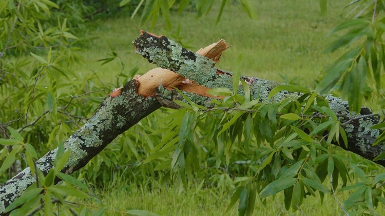
ROCK HILL, S.C. — Extensive storm damage left behind in Rock Hill, South Carolina, from a thunderstorm on Saturday was caused by excessive winds and not a tornado, the National Weather Service determined Monday.
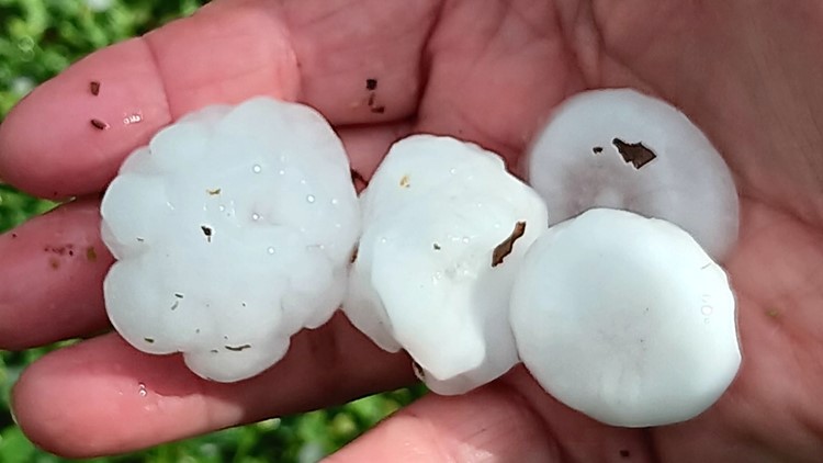
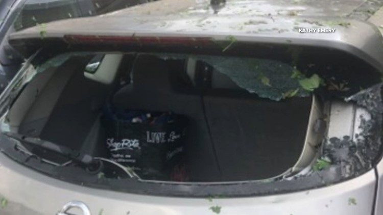
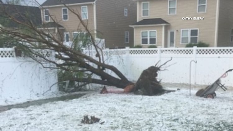
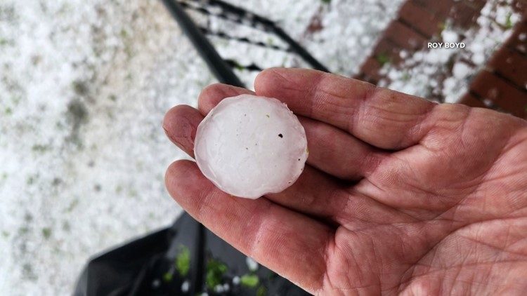
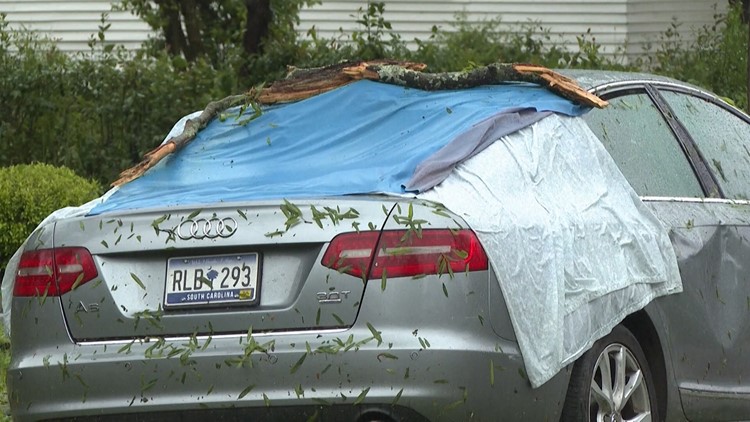
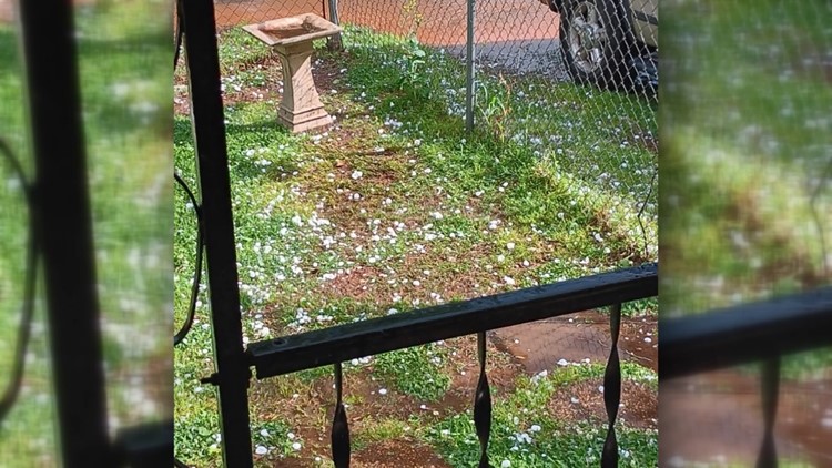
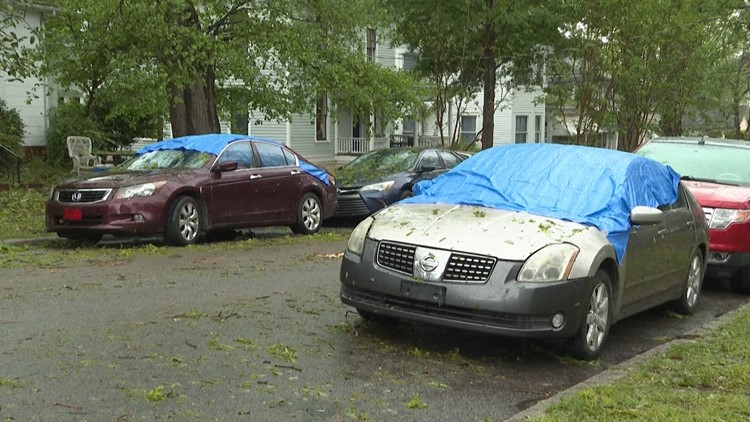
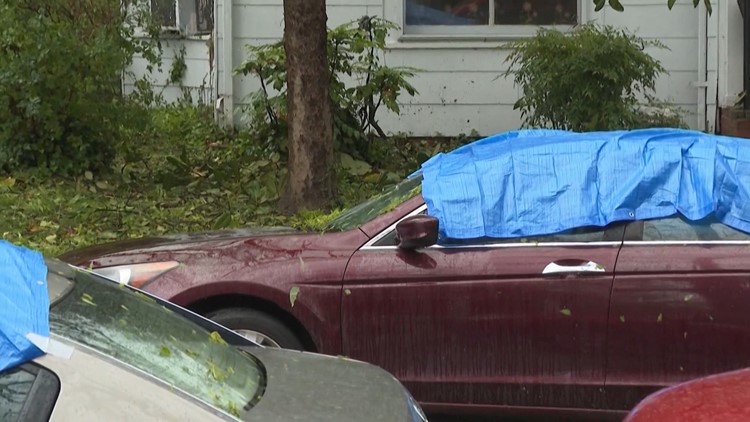
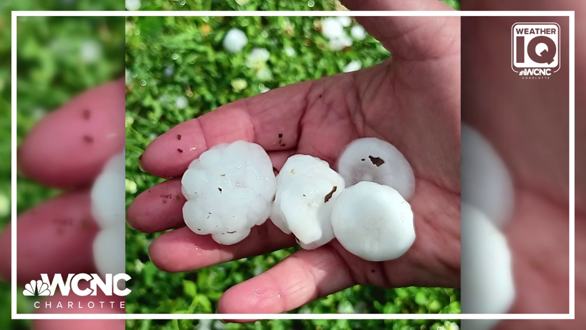
The supercell thunderstorm produced winds up to 90 mph as it moved across York County late Saturday afternoon. These winds, the equivalent of a Category 1 hurricane, toppled trees and damaged homes. The storm also produced hail stones at least 2 inches in diameter, surveyors found.
Steve Wilkinson, the meteorologist in charge of the Greenville-Spartanburg National Weather Service office, said crews are still working to determine if the storm could have produced hail up to 4 inches, as some people reported during the outbreak.
Wilkinson and officials from the York County Emergency Management office visited some of the locations hit hardest by storm damage. Their goal was to determine the strength of the storm. Their investigation also found no evidence of a tornado.
Rock Hill severe thunderstorm damage


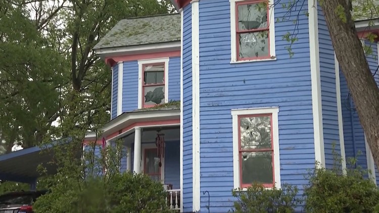


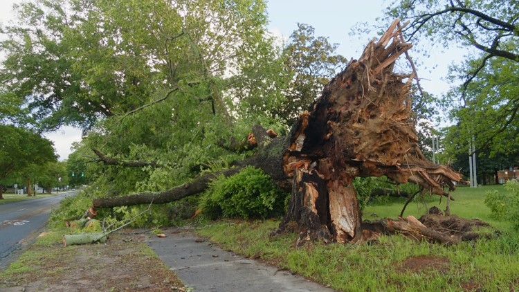

During a news conference Monday afternoon, Wilkinson justified his findings that no tornado formed. Wilkinson explained all the wind damage came from the same direction. This type of damage would suggest straight-line winds, such as that from an advancing thunderstorm. Tornado damage typically produces damage from winds circulating in multiple directions.
Wilkinson explained these findings by referencing damaged homes he saw on Monday, saying the homes were damaged on one side. He said NWS surveyors found no evidence to suggest rotating winds, such as those from a tornado.
RAISE YOUR WEATHER IQ: Wind damage and microbursts: Weather IQ
Regardless of what caused the damage, thunderstorm winds, or a tornado, the impacts are the same for the people of York County.
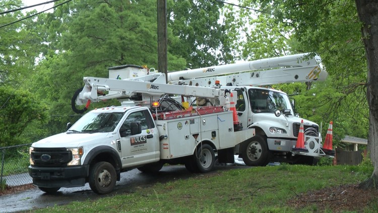
Rock Hill Schools kept students home Monday for a day of virtual learning citing impassable roads and some school buildings without power. The schools will remain in e-learning on Tuesday.
The district said some of the buses were damaged by hail and the semi-trucks that would've brought food to the schools couldn't get through because of all the debris.
"E-learning provides the opportunity for less of a disruption to instruction. We want to ensure our children continue to learn even if our facilities are unable to be open," a district spokesperson said. "For those concerned about access issues, they may reach out to their school or teacher for assistance. Every student has five days to complete the work following our return to school."
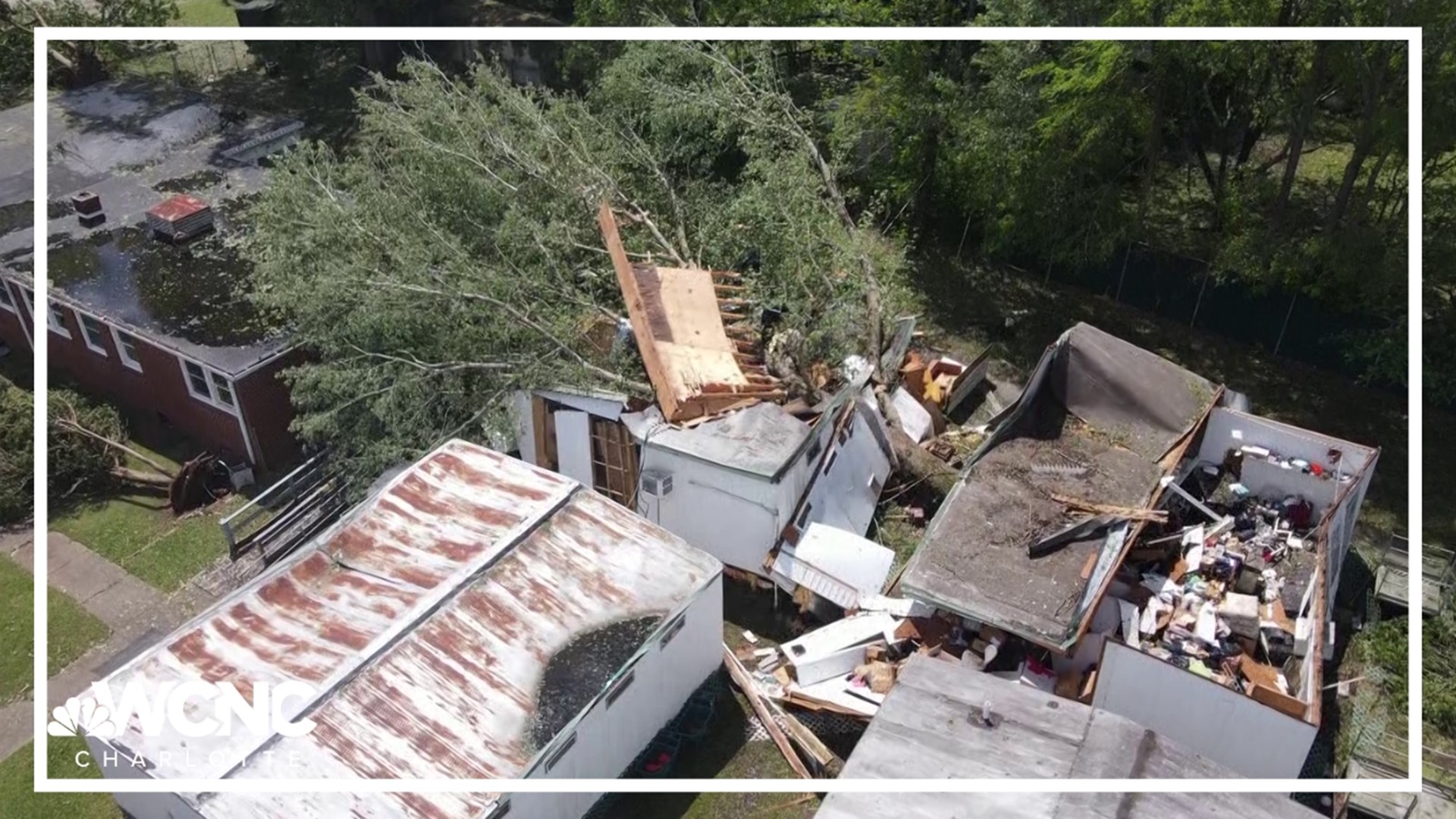
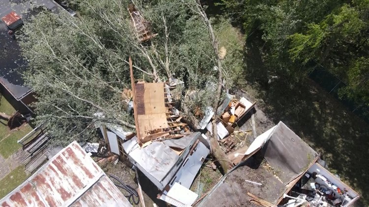
On Jones Avenue, the Redeeming Life Christian Center also suffered major damage. The church is the site of the first school to integrate in South Carolina. While, on Monday, the historic building seemed to be okay, the storm toppled trees and damaged buildings elsewhere on the center's campus
A large tree destroyed two trailers, formerly used as portable classrooms and a youth center. The trailers were being used as storage when they were destroyed.
"I really wanted to cry, but then I recognized, you know, everything happens for a reason," Bishop Eric Gailliard said. "Even though we may not like it, you’ve got to find a way to maintain your joy in the midst of the storm. Find a way to maintain your joy. Keep your peace. Keep your joy. So, now we have to clean up, but guess what? Something new is going to happen.”
The church is awaiting details from insurance and accepting volunteers and donations. Its Cash App is $RedeemingLifeHOM and can be found here on Facebook.
York County has also setup a hotline for anyone needing assistance with storm cleanup. Residents can call 803-250-3673.
People who live in the area say the brunt of the storm lasted just minutes but left major damage behind.
Surveillance video from Novelty Men's Wear on Albright Road shows the storm as it was happening. Some people are seen walking through the parking lot. Shortly after, a rush of rain and hail comes down so heavy it's difficult to see anything on the camera.
Sanjay Lalwani, who owns the store, says the American Freight business next door had its windows blown out and the roof of the gas station in the same parking lot was knocked down and left sitting on top of a car at a pump.
Lalwani said he was riding out the storm from inside his business and was thankful to be okay.
"I was inside and it was too much raining and too much noise," Lalwani said. "All balls hitting, the hail was hitting on my window. "So, I was scared too. I was thinking it might be my window that would break, but thank God nothing happened.”
WCNC Charlotte spoke to some students at Winthrop University, who described what they heard and saw. One student said he heard people screaming at the time, and another said it sounded like someone threw a bucket of rocks at the window.
The sound of rocks came from the hail.
WCNC Charlotte Meteorologist Chris Mulcahy explained the storm was able to produce such large hail stones because of its powerful updraft. These updraft winds carried the hail to 30,000 feet in the atmosphere. At this elevation, the air temperature is -40 degrees. This allowed the stones to grow to a size slightly larger than a golf ball.
During the news conference Monday, WCNC Charlotte Chief Meteorologist Brad Panovich asked Wilkinson why the National Weather Service did not activate their protocol for thunderstorms of this intensity.
While any thunderstorm is capable of 60 mph winds or 1-inch size hail qualifies for a severe thunderstorm warning, the National Weather Service has the ability to tag a storm as "destructive." This classification inside their computer system is used any time a storm has winds over 80 mph or 2.75" hail, which is the size of a baseball. When this classification is used, the Severe Thunderstorm Warning is then sent to cell phones using the Wireless Emergency Alert System. This activation would have alerted more people to the impending severe weather threat.
For the latest weather alerts, download the WCNC Charlotte mobile app and enable push notifications.
The National Weather Service Saturday issued a Severe Thunderstorm Warning for the thunderstorm. This type of severe weather warning means a storm is capable of damaging wind and hail.
With such extensive damage left behind, many speculated the storm could have formed a tornado. While winds of this speed can be just as damaging as a tornado, National Weather Service investigators visited the site Monday, in part, to see if there was any evidence the storm could have produced a tornado.
Contact Richard DeVayne at rdevayne@wcnc.com and follow him on Facebook, X and Instagram.
Contact Kayland Hagwood at khagwood@wcnc.com and follow her on Facebook, X and Instagram.
WCNC Charlotte’s Weather IQ YouTube channel gives detailed explainers from the WCNC Charlotte weather meteorologists to help you learn and understand weather, climate and science. Watch previous stories where you can raise your Weather IQ in the YouTube playlist below and subscribe to get updated when new videos are uploaded.
WCNC Charlotte To Go is a daily news and weather podcast you can listen to so you can start your day with the team at WCNC Charlotte.
SUBSCRIBE: Apple Podcasts || Spotify || Pandora || TuneIn || Google Podcasts || iHeart
All of WCNC Charlotte's podcasts are free and available for both streaming and download. You can listen now on Android, iPhone, Amazon, and other internet-connected devices. Join us from North Carolina, South Carolina, or on the go anywhere.